Getting to Prague
By Plane
Prague is served by Václav Havel Airport Prague. The airport is well connected to the city center by public transport (see here), taxi, and Uber.
From the airport to downtown by public transport
- buy a 40 CZK (for 90 min) ticket from a yellow vending machine inside the arrival terminal or at the bus stop (accepts cash and contactless cards)
- go out of the terminal to the bus stop (in front of both terminals)
- take the bus 119 downtown and get off at the final stop Veleslavín
- transfer to subway (green line A) and exit at one of the stations downtown (see more details at the Prague Airport web)
By Train
Prague has rail connections with numerous cities throughout Europe. Some connections include convenient night trains with sleeping coaches. Check the website of České dráhy (Czech Railways), the national railway operator, or the private train operators Regiojet and Leo Express. Train tickets from neighboring countries can be also obtained on the website of the corresponding national railway operators (e.g., Deutsche Bahn).
By Bus
Coach lines connect Prague with many European destinations. Check Eurolines, Regiojet, FlixBus operators or use GetByBus agregate search engine.
By Car
Prague is a major crossroads for European East-West and North-South road traffic. There are direct (or almost direct) highways that connect Prague with Nürnberg/München (DE), Dresden/Berlin (DE), Wien (AT), Katowice (PL) and Bratislava (SK). Highway electronic vignettes can be purchased here.
Getting to ELI
By Public Transport
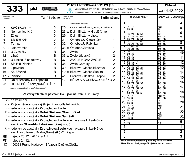
The Institute can be reached by public transport using the buses 333, 331, and 341. The most convenient bus if you are staying in the city is the number 333, which starts its journey at the Kačerov station (metro red line C). The ticket from any metro/bus/tram stop in the city to ELI costs 50 CZK (~2€). The final stop is Dolní Břežany, Obecní Úřad, which is located at ~50 m from ELI's main entrance. The bus takes 24 minutes from Kačerov and the timetable can be checked below or in the apps/websites mentioned in the following section.
Getting Around Prague
Prague Public Transport
The city of Prague is very well connected by an integrated public transport system consisting of the metro, trams, and buses. Tickets are valid for a determined period of time, during which it is possible to take any transport in any direction.
Public transport options can be checked in Google Maps, Mapy.cz, the website of the integrated public transport, or in the app PID Lítačka. Tickets can be purchased in the yellow ticket vending machines in the metro stations, inside the trams, with the bus driver, or in the app PID Lítačka. For more information about prices and connections check here.
Map of metro & tram lines
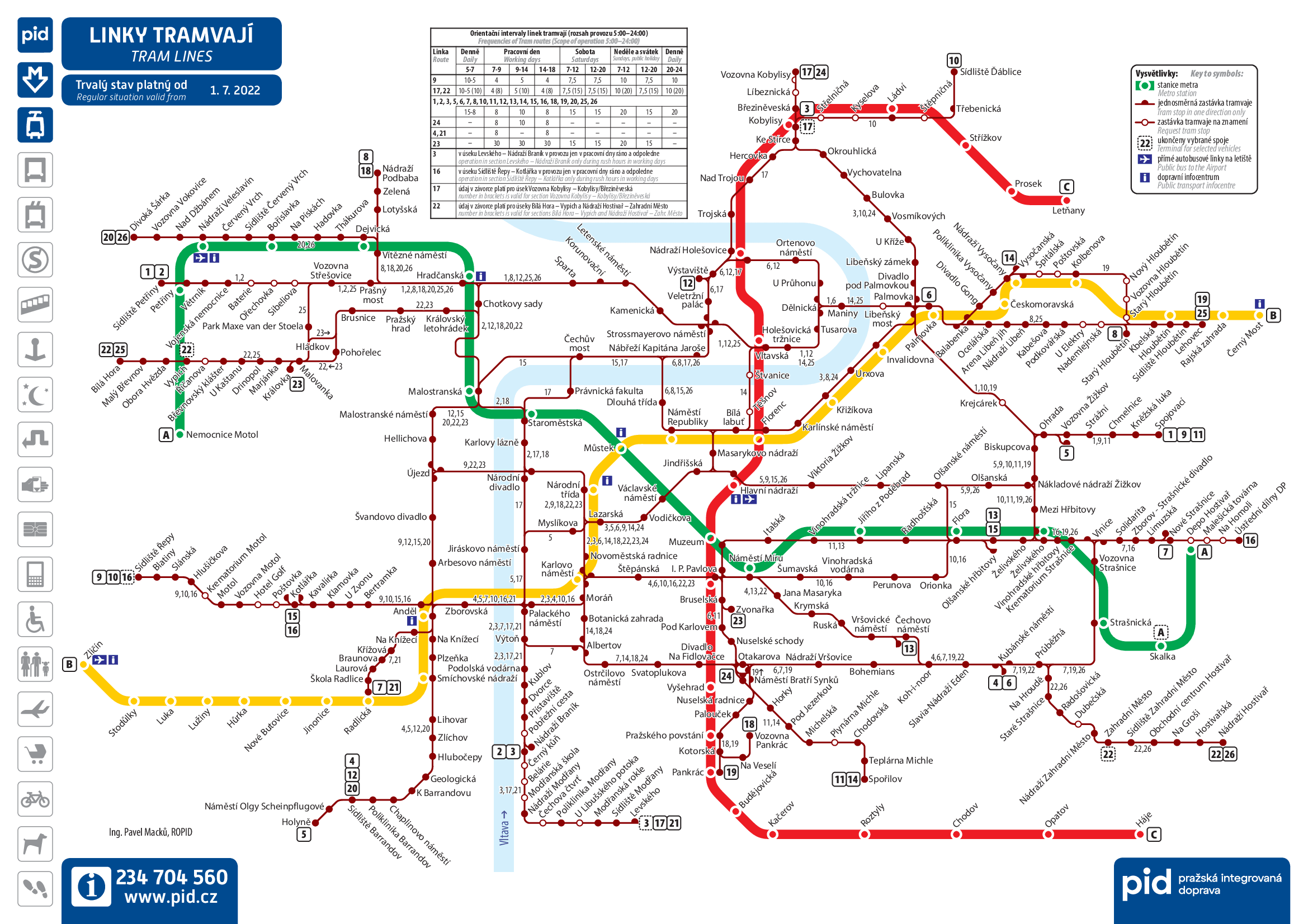
This map and other maps with better resolution are available here.
Taxi
Another option to get around Prague are taxis, Uber, Bolt, and Liftago.
Bike or Foot
If you prefer to walk, Google Maps and Mapy (also available as a mobile app – recommended!) are the best options to find your way. Mapy contains also the information about the cycling routes around Prague and allows you to find paths including touristic points. If you want to rent a bike, there are two bikesharing operators that you can check: Rekola and Nextbike. Scooters and electric bikes are offered by Lime and Bolt.